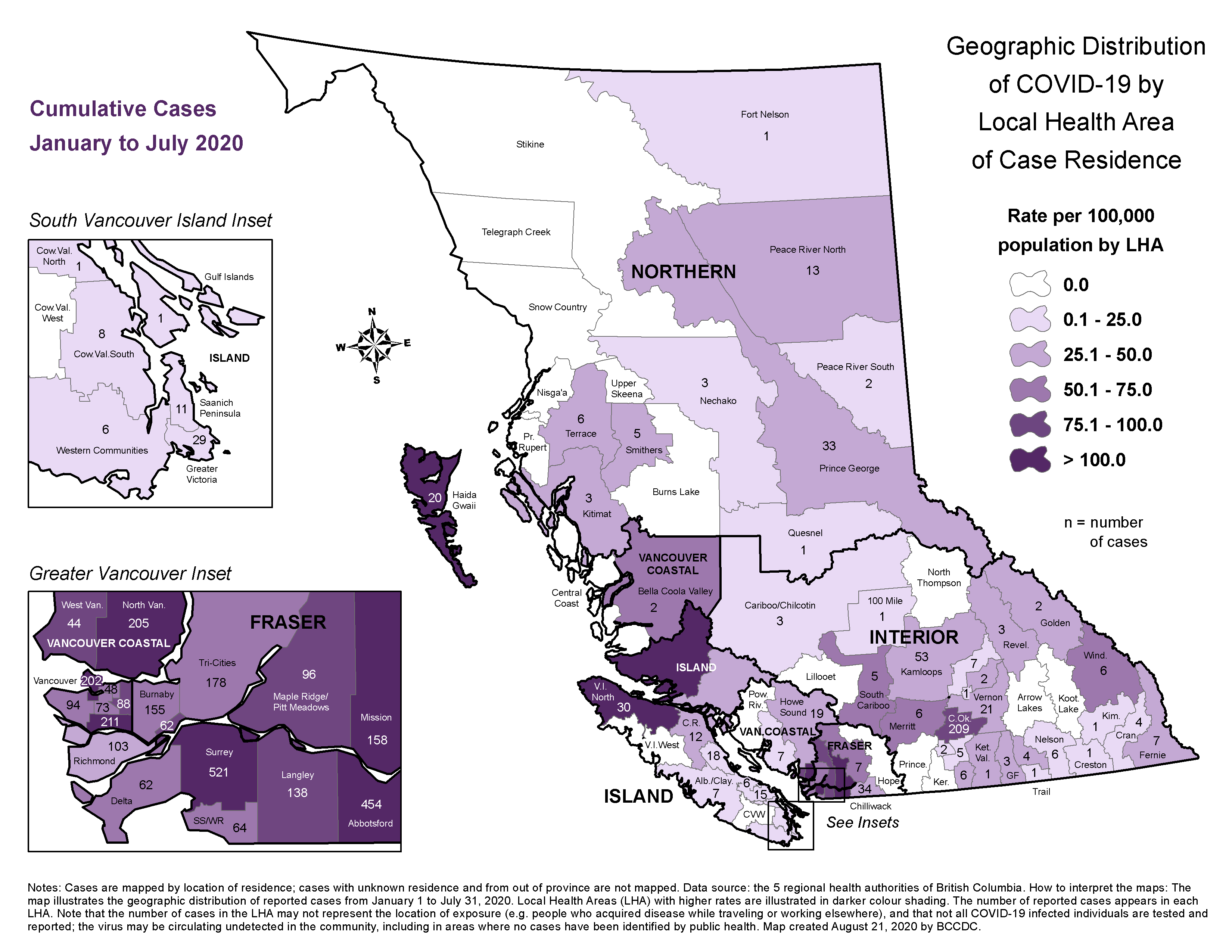
The B.C. government has just released more specific data showing where COVID has been contracted throughout the province. Since the pandemic began back in the spring, it shows, there have been 14 cases across the Skeena region.
The data is contained on a new map of “local health areas” and shows the total cases that have occurred between January and July. For the Skeena local health areas it breaks down as follows:
6 cases in Terrace
5 cases in Smithers
3 cases in Kitimat
0 cases in Prince Rupert
So far, the Skeena with 14 cases has fared better than Prince George with 33 cases, and neighbouring Haida Gwaii which has suffered 20 cases, despite a population less than 1/10 of the Skeena.
Sub-regional data wasn’t previously released because of privacy concerns. “Provincial health officer Dr. Bonnie Henry said there are enough cases now that privacy is no longer an issue,” the Northern Sentinel reports.
The new data comes as COVID cases continue to accelerate across the province, with 294 people diagnosed over the weekend.
“The increase in the number of new cases is a concern for all of us. We must to do our part and support public health teams to quickly manage new cases so we can contain the spread of the virus and ensure community spread remains low,” reads a joint statement from Dr. Henry and BC Health Minister Adrian Dix.
It goes on, “After many months of restrictions, we all felt the need to reconnect with our family and friends this summer, but now we must slow down on our social interactions and prepare for the respiratory season ahead.”