[This story originally appeared on The North Coast Review, a blog based in Prince Rupert that contains “items of interest to those living on the North Coast of BC.”]
It’s long been said that a transit through the downtown core in Prince Rupert makes for some of the most dangerous places for motorists to travel and pedestrians to cross.
And now, thanks to a new data program from ICBC, the facts back up some of the legend.
The new feature added to the ICBC website provides for a wealth of options to take advantage of when it comes to the travels of B.C.’s roads. And in Prince Rupert, a stretch from McBride and Third through Second Avenue West and Sixth Street is among the most likely locations for a vehicular mishap.
The stretch of trouble for Prince Rupert motorists starts at the Civic Centre and covers ten key intersections on McBride and further along Second Avenue West, with one side trip to Third West.
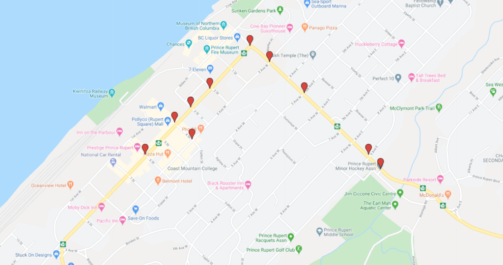
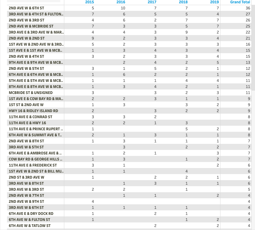
The full list of intersection accidents covers a five year period, with the Second West at Sixth Street location making for the most troublesome intersection over a five year period.
Data for Port Edward shows that there were 9 reported crashes in the Port Edward area in 2019, while Lax Kw’alaams had 3 reports for the year.
The information is compiled from information licensed under ICBC’s Open Data Licence.
The program allows the user to identify those areas of interest to them and to apply many different variables towards the reports delivered to ICBC.
You can review the full scope of the ICBC project here, and access the data files here.